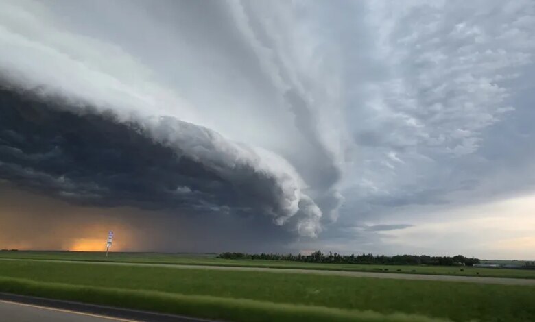
A surge of tropical moisture is turning the central and southern U.S. into a multi-hazard weather zone this weekend. The biggest concerns are damaging winds, large hail, a few tornadoes, and flash flooding that could quickly become widespread.
The threat builds after a round of destructive weather already hit the Plains and Midwest, leaving damage and outages across more than ten states. That recent system also produced confirmed tornadoes, while parts of the central and southern U.S. have already been dealing with life-threatening flooding and multiple water rescues.
Saturday brings the sharpest severe weather risk
Over 74 million Americans are in the threat zone Saturday, with the Storm Prediction Center outlining a Level 3 out of 5 severe weather risk for parts of the region. FOX Weather says organized storm clusters and a few supercells could develop as afternoon heating works with a moisture-rich air mass over Kansas and Missouri.
Heavy rain is also expected, especially around the Kansas City metropolitan area and nearby areas. Rainfall rates may reach 2 to 3 inches per hour, with some bursts topping 4 inches per hour, raising the risk of flash and urban flooding.
| Primary Saturday Threats | Areas Most Affected |
|---|---|
| Damaging winds, large hail, a few tornadoes | Central Plains into the Lower Missouri Valley |
| Flash and urban flooding | Kansas City metro and surrounding areas |
| Heavy rainfall totals over 3 inches, with localized amounts above 8 inches | Southwestern and central parts of the risk area |
The setup becomes more dangerous as storms grow into larger clusters and then a squall line. Once that happens, the main severe threat shifts toward widespread damaging wind gusts, some of which could exceed 75 mph.
Flooding threat stretches across multiple states
Flash flooding remains a major concern because the same storms are expected to produce intense rain over the weekend and into next week. A Level 3 out of 4 flash flooding risk is in place for parts of the central U.S., while a Level 2 out of 4 risk covers Oklahoma, Texas, Missouri, Louisiana, and Mississippi for Saturday and Sunday.
The FOX Forecast Center says the worst rain is likely Saturday night, when more than 3 inches could fall and localized totals may easily exceed 8 inches. With the front stalling, additional rounds of rain could keep the flooding threat in place and even expand it into the middle of next week.
The South faces a longer stretch of heavy rain
By Saturday afternoon, low pressure moving out of the Rockies is expected to intensify as it tracks into the Central Plains. A cold front will trail from Kansas through Texas, while a warm front reaches north into the Great Lakes.
South of the warm front, Gulf moisture will keep building instability across the Deep South. That is likely to support repeated rounds of thunderstorms and heavy rain through the end of the weekend and into next week.
Through early next week, widespread rainfall totals of 2 to 3 inches are possible from Texas through Tennessee, with localized totals around 5 inches or more. FOX Weather says the stalled front could keep producing multiple rounds of rain, which means the flash flooding risk may last longer than the weekend itself.