

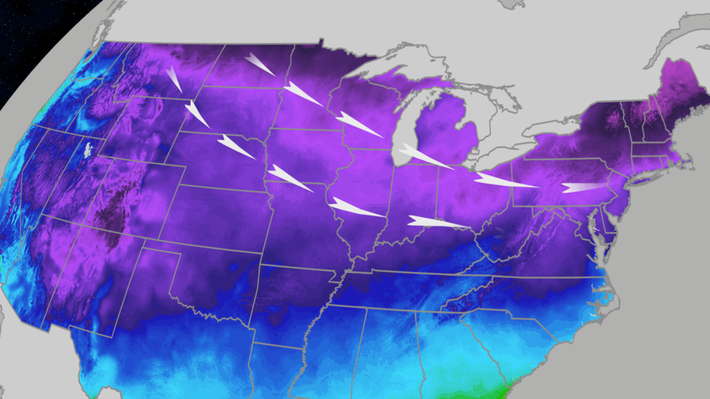
A powerful surge of Arctic air is driving temperatures far below zero across the upper Midwest this week. The cold snap threatens to break numerous daily temperature records from the nation’s heartland through the Northeast by Friday.
On Wednesday, Aberdeen, South Dakota, matched its record low of minus 18 degrees, while Thursday morning brought readings in the teens below zero to Iowa, Minnesota, South Dakota, and Wisconsin. Wind chills plunged into the 20s below zero over parts of these states, intensifying the frigid conditions.
Forecasters predict that another dozen or more daily record lows could fall by Friday. Major cities at risk include Chicago, Pittsburgh, and New York City’s JFK and LaGuardia airports. Record-setting daily high temperatures in the Midwest and some eastern cities, such as Detroit, Milwaukee, and Roanoke, Virginia, are also possible.
Timeline of Arctic Cold
-
Thursday: Daytime temperatures will remain below freezing for millions, with highs hovering in the teens in many Midwestern areas. Even southern locations like Oklahoma City struggle to rise above freezing, with temperatures 15-25 degrees below normal.
- Friday: The cold expands further south and east, bringing single-digit and teens lows across the Great Lakes and New England, including Boston. Subzero temperatures may occur in upstate New York and northern New England, while cities like New York and Philadelphia experience lows near 20 degrees.
While the cold prevails, light snow is possible along the northern tier and in parts of the Appalachians. These may occur as fleeting snow squalls causing sudden whiteout conditions, mainly affecting northern New England and areas south of Washington, D.C.
A reinforcing wave of cold air arrives Saturday, extending into the Northern Plains and upper Midwest. Temperatures will struggle to climb out of the single digits and teens through Sunday. This chill moves eastward by Monday, pushing temperatures sharply downward along the I-95 corridor. Cities such as Philadelphia, New York, and Boston may experience high temperatures barely above freezing, accompanied by chilly winds.
Despite the severe cold, the Plains will see a reprieve early next week with highs rising into the 50s across Montana and the 60s near Denver. This temporary warming provides a brief break amid an extended cold season.
This forecast highlights a period of historically cold weather affecting tens of millions across the central and eastern United States. Residents are advised to prepare for dangerous cold conditions and monitor local weather updates.
Read more at: weather.com