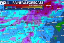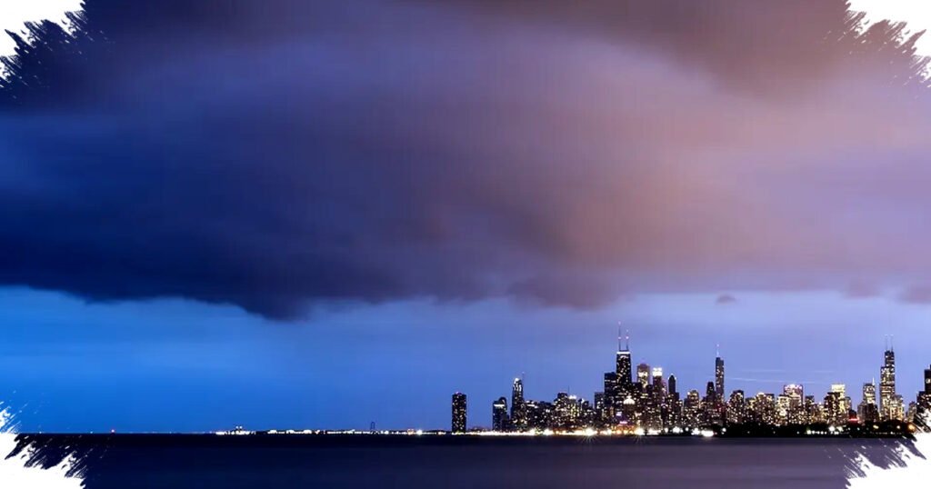
Severe storms are moving through the Chicago area and northwest Indiana, with the main threat period expected from mid-afternoon into the evening as a strong cold front pushes across the region. Forecasters say the system could bring damaging wind gusts, large hail, isolated tornadoes in the southern part of the area, and a fast drop in temperatures by nightfall.
The National Weather Service in Chicago said scattered storms are already developing and that the severe weather threat should taper off by late evening. A severe thunderstorm watch remains in effect for parts of Illinois, Indiana and Iowa through late night, with the highest risk concentrated along and south of I-80.
Storm timing and strongest impacts
Meteorologists said the most active window for severe weather runs from about 3 p.m. to 11 p.m., with the greatest chance for strong storms during the late afternoon and early evening. FOX 32 Chicago Chief Meteorologist Emily Wahls said the overall severe risk has shifted slightly south, placing the Level 3 enhanced risk mainly south of I-80.
The Storm Prediction Center also placed the far southern sections of Chicagoland under an enhanced risk, which is where the strongest storms are most likely to form. Areas near and south of the Kankakee River Valley are being watched closely because of the higher chance for isolated tornadoes.
Primary hazards across the region
The main concern remains severe thunderstorms capable of producing damaging wind gusts and large hail. Some storms have already produced lightning and small hail, and forecasters expect activity to intensify through the afternoon as the atmosphere becomes more favorable for stronger cells.
- Large hail
- Damaging straight-line winds
- Isolated tornadoes, mainly south of I-80
- Localized flooding in southern areas
Officials said the tornado threat is lower than it was during the March 10 outbreak, but it is not zero. The National Weather Service noted that a few tornadoes cannot be ruled out, especially in the southern part of the warning area.
Airport disruptions and live impacts
Weather conditions also affected air travel at O’Hare Airport as storms moved closer to the Chicago metro area. According to live updates, a ground stop was issued, then extended multiple times as severe weather continued to disrupt operations.
The timeline of airport impacts included a ground stop first issued in the late afternoon and then extended later in the evening. Such delays often signal more widespread storm impacts, including lightning, strong winds and reduced safety margins for takeoffs and landings.
Cold front brings sharp temperature drop
Behind the storms, a powerful cold front is moving through the region and dragging much cooler air into Chicagoland. Temperatures are expected to fall into the 40s by tonight, and the National Weather Service said some places could see a drop of as much as 25 degrees in a short time.
That quick change will make conditions feel dramatically different by late evening compared with earlier in the day. Low temperatures tonight are expected to fall to around 30 degrees, keeping the area chilly through Friday.
What to expect after the storms
Friday is expected to stay cool, with highs in the low 40s and partly sunny skies. A gradual warm-up should follow over the weekend, with temperatures near 50 on Saturday and into the low 60s on Sunday.
By Monday, highs could approach 70 degrees before rain chances return early next week. The shift from severe storms to cold air and then a warmer weekend pattern highlights how quickly spring weather can change across the Chicago area.
Read more at: www.fox32chicago.com