

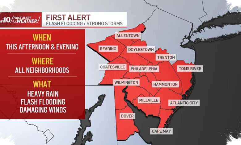
Philadelphia is facing a steamy, stormy Thursday, with humidity building and the risk of damaging wind and flash flooding back in the forecast. NBC10 Philadelphia issued a First Alert for the afternoon and evening as heavy rain and strong thunderstorms move into the region.
The main concern is that all neighborhoods could see heavy downpours, and some storms may become severe. Damaging winds are also possible, adding to the threat for commuters and anyone caught in the strongest cells.
What Thursday’s setup means
| Forecast Factor | What NBC10 Philadelphia Says |
|---|---|
| Humidity | Building back into the area and helping fuel storms |
| High Temperature | 84° |
| Feels Like | 90° in Philadelphia |
| Main Risks | Heavy rain, flash flooding, damaging winds |
Friday is expected to stay hot and mostly cloudy, with a chance of isolated strong storms. Some neighborhoods could see downpours again, but NBC10 Philadelphia says the severe storm and flood threat is not as great as it is Thursday afternoon.
Weekend relief may be brief
Saturday could bring lingering morning showers before some sunshine breaks through in the afternoon. The day should end partly sunny with a high near 84°.
Sunday looks much calmer, with partly sunny skies and a high of 85°. Monday is also expected to be a nice summer day at 85°, with humidity coming down on both days.
The quieter stretch may not last long. Temperatures are forecast to climb into the 90s on Tuesday, marking the start of a run of 90° days that could continue into next weekend.