A powerful winter storm is rapidly intensifying off the East Coast and is set to impact New York City and the broader Northeast with severe blizzard conditions. Authorities have expanded blizzard warnings across a vast region stretching from Delaware through the Mid-Atlantic up to southern New England.
State and local governments have declared emergencies to prepare for the storm’s arrival. New Jersey’s governor declared a state of emergency starting Sunday afternoon as significant snow is expected. Likewise, New York Governor Kathy Hochul issued emergency orders for 22 counties from early Sunday. Philadelphia’s mayor, Cherelle Parker, announced a local snow emergency beginning Sunday afternoon.
Preparations in New York City have been bolstered compared to recent winter storms. Mayor Zohran Mamdani warned that the upcoming conditions could surpass those of last month’s winter storm. Additional snow-removal crews and equipment have been mobilized ahead of the storm. More than 40 warming centers will open across the city, and outreach teams will beef up efforts to assist individuals experiencing homelessness.
Blizzard warnings now affect millions of residents in metropolitan areas including Philadelphia, New York City, and Boston. This marks the first blizzard warning for New York City since 2017. According to the National Oceanic and Atmospheric Administration (NOAA), the storm is projected to produce significant, potentially dangerous impacts from Delaware’s DelMarVa Peninsula to eastern Pennsylvania, across much of New Jersey, the New York Tri-State Area, and down through southern New England.
Heavy snowfall totals are anticipated, with 12 inches (30 centimeters) or more likely from Philadelphia through New York City to Boston. Areas further south—including Baltimore—are also expected to receive several inches of snow, while Washington, D.C. may see smaller amounts. The snow is predicted to be dense and wet, accumulating on trees and power lines. Combined with strong gusts exceeding 40 mph (65 km/h), this could result in broken tree branches and localized power outages. Coastal gusts may reach up to 55 mph (90 km/h).
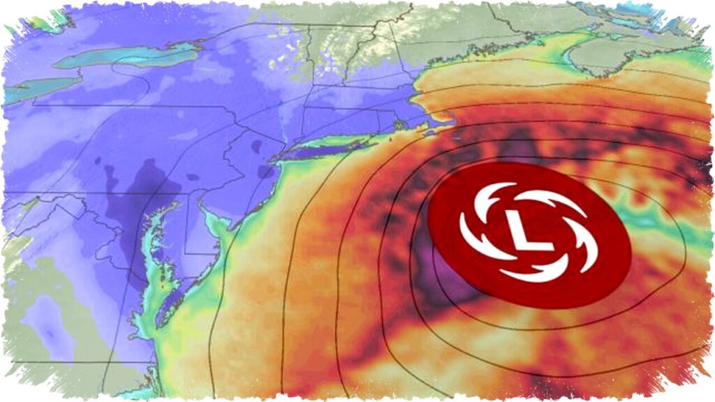
The storm’s strong winds will push ocean water inland, producing moderate to locally significant coastal flooding from Delaware and New Jersey to Long Island and southern New England. The highest water levels are expected during high tide late Sunday night into early Monday morning.
Travel disruptions are already severe and expected to worsen. Over 6,000 flights have been canceled nationwide on Sunday and Monday, heavily affecting major airports such as New York’s JFK and LaGuardia, and Boston Logan International. Airlines have advised passengers to check for updates and have offered flexible rebooking options.
With the storm poised to rapidly strengthen into a “bomb cyclone” off the coast, severe weather conditions will escalate throughout Sunday evening. Snowfall rates may reach 1 inch (2.5 cm) or higher per hour, accompanied by damaging winds. The most intense weather will continue overnight into early Monday, especially impacting travel and safety in Philadelphia, New York City, and southern New England.
Storm conditions will gradually improve Monday afternoon as the snow and wind diminish from the south toward the north. However, lingering effects may persist in parts of New England into Monday evening. Residents are strongly urged to heed official warnings, limit travel plans, and prepare for disruptions in power and transportation during the storm’s peak.
This significant winter event marks the first time in over five years that Central Park in New York City is expected to receive more than 12 inches of snow. The storm highlights the importance of ongoing monitoring and preparation to mitigate public safety risks across the Northeast corridor.