

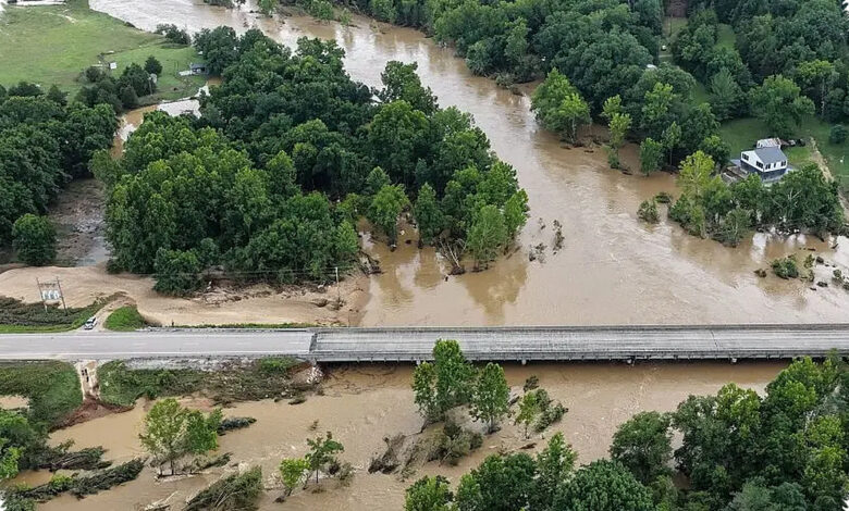
Days of storms are expected to unload heavy rain across parts of Texas, the Gulf Coast and the South through Friday, raising a serious flash flood threat. The greatest concern centers on Texas’ Big Bend and Hill Country, where storms may keep tracking over the same areas.
That setup is especially concerning for communities along the Guadalupe River in Texas Hill Country, one of the areas devastated by flooding last July 4, when 135 people were killed. The new threat comes as the region once again faces the risk of repeated rounds of rain.
Flood risk spreads across a wide stretch of the South
Noaa’s Weather Prediction Center has placed a Level 2 out of 4 flash flood risk on Monday from western North Carolina to Texas’ Big Bend. The zone includes parts of southeastern Virginia, East Tennessee, South Carolina, Georgia, central and southern Alabama, central and southern Mississippi, much of Louisiana, eastern Oklahoma and much of central and western Texas.
That outlook also covers major cities and metros including New Orleans, Houston, Austin, San Antonio and parts of the Dallas metroplex. Fox Weather says the broad threat is being driven by a cold front sliding south and colliding with warm, humid air from the Gulf.
| Day | Main Areas Mentioned | Flood Threat |
|---|---|---|
| Monday | Western North Carolina to Texas’ Big Bend, including Houston, Austin, San Antonio and New Orleans | Level 2 of 4 risk |
| Through Tuesday | Gulf Coast into Central Texas | Widespread 1-3 inches of rain expected |
| Midweek | West and Southwest Texas, including Hill Country | 5-8 inches of rain possible, with Level 3 risk in parts of the Big Bend west and north of San Antonio |
Through Tuesday, Fox Weather’s forecast center says a broad swath from the Gulf Coast into Central Texas can generally expect widespread totals of 1-3 inches of rain. On Tuesday, the flood threat shifts mainly to the Texas Plains, including Austin and San Antonio, while storms linger across the Southeast.
Midweek could be the most dangerous stretch for Texas Plains
By the middle of the week, storms are poised to dump between 5 and 8 inches of rain across West and Southwest Texas, including Hill Country. A Level 3 flash flood risk currently covers parts of the Big Bend west and north of San Antonio.
Fox Weather says flood watches will likely be needed at some point, and warns that the storm setup is being forced by “the massive heat dome locked over the northern half of the country” pushing a weak storm system underneath it into the southern Plains.
Travelers headed to Big Bend National Park this week are being urged to closely monitor the forecast and local advisories. The risk remains focused on repeated storms, which can quickly turn already wet ground into dangerous runoff and flash flooding.
This week’s forecast follows deadly flash flooding along the Black River in southeastern Missouri, where a Flash Flood Emergency was issued across Iron and Reynolds counties on Friday. Some locations there picked up between 9 and 12 inches of rain that morning.
Fox Weather says to check back as the forecast develops through the week, since the heaviest rain and highest flood risk may shift as the storm pattern evolves.