


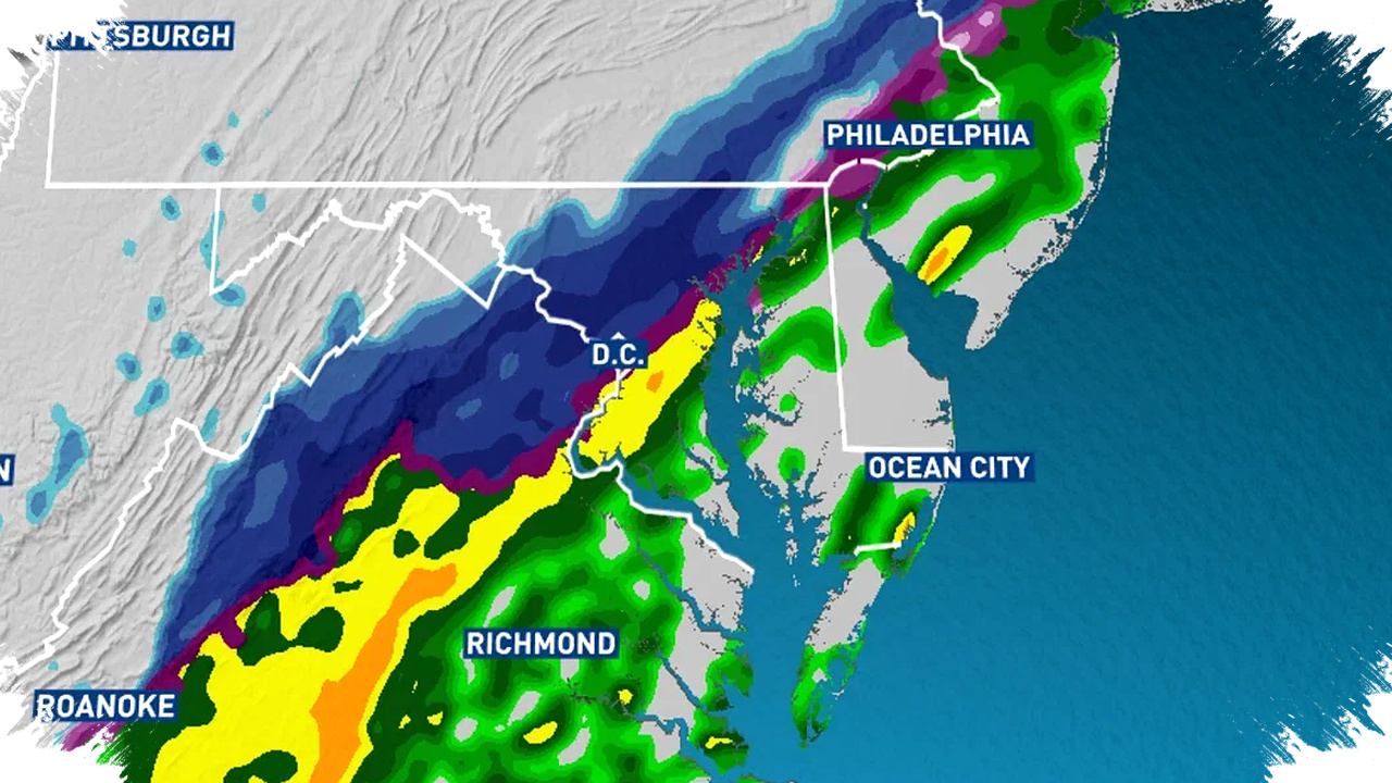
The Mid-Atlantic region recently witnessed a swift shift from record-setting warmth to near-wintry conditions within just 24 hours. Temperatures soared to an unprecedented 84 degrees at Reagan National Airport, surpassing the 2016 record by 5 degrees.
Following this historic heat, the area is bracing for a rapid cooldown as a cold front moves in from the west. Forecasts indicate that warm conditions will persist through Wednesday night, only to be replaced by a sharp temperature drop starting Thursday morning.
Record-Breaking Warmth
On Tuesday afternoon, the Mid-Atlantic’s temperatures climbed well into the 80s, an unusual feat during this period. Meteorologists noted that the 84-degree reading at Reagan National Airport set a new high mark, underscoring a significant deviation from typical seasonal norms. Wednesday is expected to sustain similar warmth, with the possibility of additional records being broken.
Cold Front and Temperature Plunge
A powerful cold front approaching from the west is set to alter the weather dramatically. The warmer air mass will dominate through the night, but by Thursday morning, temperatures will plunge from the 50s to the upper 30s and lower 40s. This rapid cooling will coincide with gusty winds reaching between 20 and 30 mph, intensifying the chill in the air.
Wet Snowflakes and Windy Conditions
Despite the absence of meaningful snowfall accumulation, some areas could experience wet snowflakes mixed in with rain during the cold air intrusion early or late Thursday. This mix of cold rain and sporadic wet snowflakes will mark a striking contrast to the record warmth observed just the day before. The wind will also grow stronger, creating blustery conditions that will emphasize the stark temperature swing.
Key Weather Highlights:
- Record high of 84 degrees recorded at Reagan National Airport.
- Consecutive days with highs near or above 80 degrees.
- Cold front arrival late Wednesday night.
- Steep temperature drop on Thursday morning to the 30s and 40s.
- Gusty winds of 20-30 mph adding to chill factor.
- Potential for wet snowflakes mixed with cold rain, no accumulation expected.
Residents are advised to prepare for the rapid shift from warmth to cooler, wetter conditions. The contrasting weather patterns demonstrate the volatility typical of this transitional season, underscoring the importance of staying updated through reliable weather sources.
These unusual temperature swings highlight the dynamic nature of the region’s climate during this time of year, reflecting broader patterns influenced by atmospheric disturbances. Monitoring local forecasts and weather alerts will remain essential as the situation evolves.